Grouse Falls Trail
The deep, rugged canyons of this area remind us of the hard work and remote life of the early miners who lived and worked in many of the drainages of the area.
The Grouse Falls Overlook trail is 0.5 miles long. It begins at Forest Road 33-26 and ends at a wooden deck overlooking the Grouse Falls cascade, which drops several hundred feet into Grouse Creek. The deep, rugged canyons of this area remind us of the hard work and remote life of the early miners who lived and worked in many of the drainages of the area.
- Distance .5 mile each way
- Difficulty Easy to moderate
- Website Grouse Falls Trail
- Best Feature Beautiful view of the Grouse Falls cascade.
- Hiking
- Picnicking
- Waterfalls

From Interstate 80, take the Foresthill exit to Foresthill Rd and proceed 15.5 miles to the Foresthill Ranger Station. Continue 1.2 miles and turn right onto Mosquito Ridge Rd, following it 19¼ miles to the Peavine Rd intersection (Road 33), then drive almost 5 miles on this graveled road to the Grouse Falls turnoff. At the end of this short spur (note: road is not recommended for low vehicles) is a parking area where the trail begins.
ALSO CHECK OUT:
-
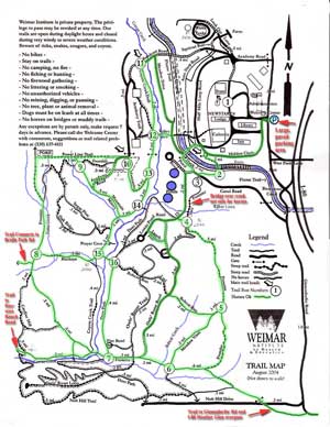
Weimar Institute Trails
Weimar, CA20601 West Paoli Lane, Weimar, CA 95736Extensive network of trails through oak/pine/manzanita forested areas with seasonal and year-round creeks and some natural meadows. Some trails have “tunnels” through old manzanita groves.
-
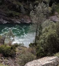
Confluence Interpretive Trail
Auburn, CAHighway 49 S, across from ASRA Park HQ, Auburn, CA 95603The confluence of the North and Middle Forks American River affords a marvelous opportunity to view the natural wonders of this river canyon environment and to glimpse the past via the remains of its historic bridges.
-
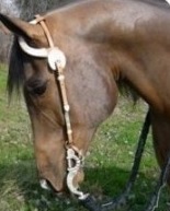
Willow Lake Ranch Equestrian Training
Newcastle, CA1255 Monument Place, Newcastle, CA 95658Willow Lake Ranch has a great selection of lesson horses suitable for small children and adults just starting their riding careers. They also have horses suited to more advanced riders or you may use your own horse. Lessons are offered for both English and Western riding styles.


