Pointed Rocks Trail
This steep trail offers great bird’s eye views of the confluence and American River canyons.
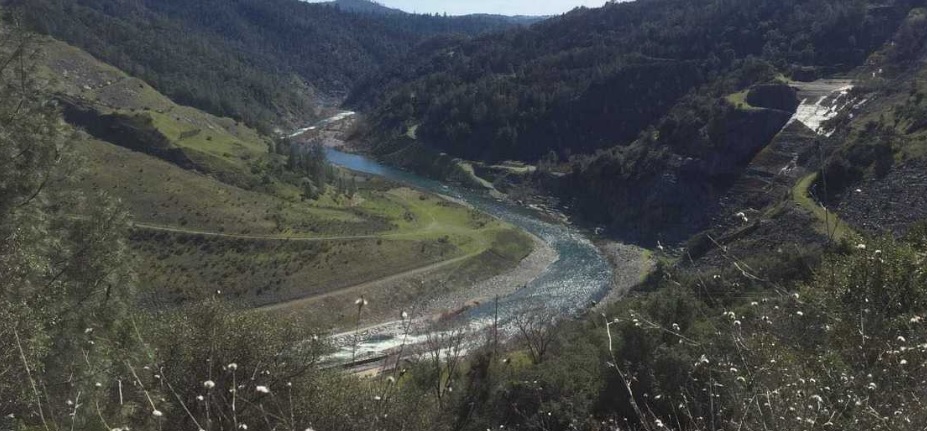
This steep trail offers great bird’s eye views of the confluence and American River canyons. On clear days, it offers sweeping views of the Sacramento Valley to the west and the Sierras to the east. Its steep gradient offers a good aerobic workout, climbing 1000 ft in 1.2 miles. It follows a buried telephone cable on its ascent from the confluence area to the ridge and the Olmstead Loop. After reaching the ridge, the trail passes through open, rolling hills and meadows dominated by several species of oaks, and wildflowers in the spring. Limestone outcroppings at the top give the trail its name.
- Distance 1.6 miles one way. This does not include distance to trailhead. A variety of loop options are available.
- Approx length of time 1½ hours up, ¾ hours down (hiking)
- Difficulty Moderate to Difficult
- Website Pointed Rocks Trail
- Best Feature The Pointed Rocks Trail is sometimes referred to as “The Training Hill” on trail markers since it offers a great workout for endurance runners and equestrians.
- Hiking
- Equestrian
- Steep Gradients

Trailhead is on Hwy 49, 1¾ miles south of ASRA Park Headquarters. Take Hwy 49 south from Auburn towards Placerville. After crossing the American River, park on the right off the highway. Walk to trailhead through the green gate (#150).
ALSO CHECK OUT:
-
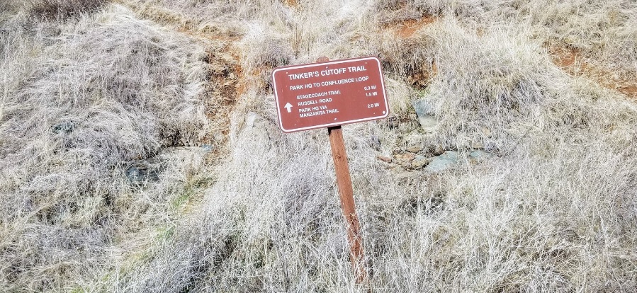
Tinker’s Cutoff Trail
Auburn, CAOld Foresthill Road, Auburn, CA 95603This single file trail offers an alternative route to and from Stagecoach Trail from the confluence area.
-
Wilderness Archery, Inc.
Rocklin, CA4870 Pacific Street, Rocklin, CA 95677Aisle displays hold a wide variety of tools that you’ll need to keep your archery tackle well maintained and tuned.
-

Meeks Bay Resort
Tahoma, CA7941 Emerald Bay Road, Tahoma, CA 96142The resort offers direct beach access, a grill-style restaurant and free parking. Recreational facilities include boat and bike rentals, beach volleyball, lake tours and fishing, along with hiking trails.


