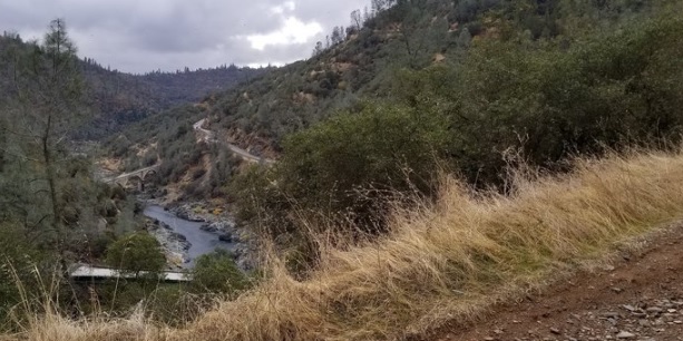
Upper Stagecoach Trail
While not as wide, level or well graded as Stagecoach Trail, it provides another perspective on the canyon, and has some shade.
Trail goes from Stagecoach Trail to Stagecoach Trail. While not as wide, level or well graded as Stagecoach Trail, it provides another perspective on the canyon, and has some shade. On clear days it is possible to see the snow-capped Sierra Nevada as well as views both up and down the American River Canyon. There are two locations where there are benches from which to enjoy the views along the way. The trail crosses several small oak meadows. It also provides a good view of the imposing Foresthill Bridge and some opportunities to watch hikers and bikers below on Stagecoach Trail.
- Distance 1 mile one way; this does not include the distance walked on Stagecoach Trail to the trailhead. Access to this trail is from Stagecoach Trail.
- Approx length of time ½ hour (hiking)
- Difficulty Easy to moderate
- Website Upper Stagecoach Trail
- Best Feature On clear days it is possible to see the snow-capped Sierra Nevada as well as views both up and down the American River Canyon.
- Hiking
- Biking
- Canyon Views

Parking is off Russell Rd. From I-80 exit at Foresthill. Turn right (west) on Lincoln Way. Follow Lincoln Way for about ½ mile and turn left onto Russell Road. Drive slowly as many residents, children, and pets may be walking or biking along this single lane road. After about ½ mile, there is a small parking area on the left as you round a curve to the right. Trailhead is behind the parking area beyond green gate (#138).
ALSO CHECK OUT:
-

Tahoe Adventure Company
Tahoe Vista, CA7010 North Lake Boulevard, Tahoe Vista, CA 96148The Tahoe Adventure Company leads high quality adventure travel trips and tours with a focus on experiencing the natural beauty of the surrounding mountains, trails and brilliant waters of Lake Tahoe.
-

Tahoe City Winter Sports Park
Tahoe City, CA251 North Lake Boulevard, Tahoe City, CA 96145From the convenience and comfort of a full service lodge, you can access the sledding hill, 4 km of cross country trails, a snow shoe loop, and brand new ice rink.
-

Black Oak Golf Course
Auburn, CA2455 Black Oak Road, Auburn, CA 95602During the past twenty-five years, Black Oak Golf Course has been transformed from a diamond in the rough to the jewel in the crown of nine holes golf courses in Northern California and the Auburn, CA golf community.


